Finishing touches

This is our last post on the multimedia course. The only thing that has to be done is to give all of you our finished products. This is for both the visualization as our paper.

The finished paper can be seen on the following link Verslag our final paper. Our final visualization of the crowdsourced data can be seen on the following link. For people who are interested in the source code of this visualization, they can download if from the following link. Due to some troubles with disclosing the KU Leuven data we cannot provide the source code or the visualization online. Our time planning is still visible on the following link

So that was all, rest me only to wish everyone happy holidays!

Evaluation teams

During the last session from the multimedia course, every team needed to give a presentation and based on this presentation and the work done during the semester we (as a team) needed to grade them. We got 20 points to deliver to 4 teams, in this blog we give a rationale for our marks.

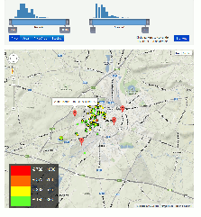
1. MuMe13: PeopleFlow (7)

We found that the given presentation was good, they provided us with a nice overview of what they had done over the last semester. The visualization created was also very good, with some minor remarks on sliders. We liked that they had changed the threshold slider after the remarks given last week. A small problem with the visualization is how to get the real migration data, using the top 10 was good but an extra visualization would have been better.

+ Good looks
+ Good to draw conclusions
– Retrieving the exact data

2. ToPiJa: Soccer (6)

Their presentation was good, it was a shame though of the provided example. There was some confusion on how the visualization shows whether Genk or Gent is better. Our opinion was that this was rather well illustrated by the visualization because both are on average good but actual there exists a big differences between both teams.
We like the visualization because it gives a clean overview of the evolution of the teams ranking. The last minute added functionality of coaches was nice although it could have been better worked out. Provide insight in the effect of the new coach was not retrievable.

+ Good looking visualization
+ easy to use
– Slow and uses a lot of CPU
– functionality of coach could be better

3. PeStAd: Music (3)

The presentation of this team was fun, the interaction between both PC was a nice touch, it is a shame that this is not possible in the real visualization. The improvement of the visualization over the last 3 weeks was impressive although we think that with little effort, it could have been a bit more clean/professional. We do not like the amount of options you can click and also do not see the usefulness of having all the different characteristics of a bar (Of 8 characteristics, 4 almost always look the same). Lastly we think it was a pity that they did not evaluate their visualization thoroughly.

+ Good effort last weeks
– Changes in looks needed
– Limited evaluation

4. MaMoth: League of Legends (4)

The good thing about the presentation was that they used a lot of time to illustrate their visualization, this was needed because it is not trivial to understand. The problem with the presentation was that there was not a complete story, more some pieces scrambled together. We did however like the effort they put into it, during the last weeks with some extra functionality (lines to illustrate that champions work well together). Another positive point  for us was that they clearly listened to the feedback they got over the weeks and they adjusted the visualization accordingly. It was a shame that the win/lost ratio was not based on real data. We also had a problem with the fact that they did only a limited evaluation, it would have been interesting to see how the visualization worked with real people.

+ Nice end result
+ Listening to feedback
– No real win/lost ratio
– Limited evaluation

Update visualisation

This week our main focus went to the integration of the data received from the student housing department of the KU Leuven. Therefore there are only some minor tweaks in our existing visualization, which can be viewed here.

The integration with the KU Leuven data has proven to be a lot more difficult than initially expected but is now almost finished. Due to a contract we signed, we cannot post the complete visualisation here but we have made a .gif file that shows the current state (click image below to view). When we have completed our visualisation we will send it to the housing department for approval. Afterwards we will be able to show you the official visualization (online).

rangefiltersizechange

The most important improvements that still need to be done in the version with the KU Leuven data are :

  • add characteristics of individual locations when you hover over them.
  • add data of the different studies on a single location
  • do some fine tuning

Evaluation results

Last week, we did a post on how we would evaluate our student housing visualization. This week, we tested our visualization with nine different people. In this document, we’ve gathered the notes we took during testing (in dutch, quickly written down). Here’s a short summary:

  • When trying to find a suitable residence by using our visualization, a lot of different behaviors were observed:
    • Two persons tried all the different functionalities that our visualization offered and repeatedly switched between them to make his decision.
    • Two persons started their search based on the location of residences (either close to the station or close to the campus). Other functionalities were used to refine the selection. (Remark 1: neither of them found the ‘filter by travel time’ functionality on its own) (Remark 2: two of the test persons tested with a version were this functionality was not present).
    • One person didn’t use any of the filtering or coloring functionalities, only the positions of the residences on the map.
    • The four remaining test persons used some of the functionalities, based on what they thought were important selection criteria.
  • When answering questions that required the test persons to utilize specific functionalities of the visualization, they performed rather well: they were able to determine which functionalities would lead them to the answers and they had little trouble making a conclusion based on what the visualization showed them.
  • Comments/thoughts from the test persons:
    • Four persons mentioned they enjoyed playing with the functionalities to explore the data.
    • Two persons reflected on their own (current) residence (eg ‘quite expensive compared to what i see here’)
    • Three persons mentioned the 10min-travel time filter would be more useful if it was limited to 5min. (Three out of the seven persons that tested this functionality)
    • One person found that it would be useful to include warehouses
    • Another person would like to see extra information about the facilities of the residences
    • Some remarks were given related to bugs and usability issues

After this face-to-face evaluation the test persons were asked to fill in this questionnaire. We also asked other people to spare a moment to play with our visualization and fill in the questionnaire. Here are some general results (15 people at that time):

evaluatie001

(1 means ‘completely disagree’, 5 means ‘completely agree’)

evaluatie002

evaluatie003

evaluatie004

As you can see, our visualization does a good job giving people more insight in the data. Also, if people were to find a new residence, they would benefit from using this visualization (although we weren’t able to test with a completely new student who is currently looking for a residence). On the subject of search criteria: when choosing a residence, it turns out that the field of study is not considered important. However, we still think it a good idea to include it in the visualization, since our face-to-face testing revealed that it is one of the characteristics that is most used when exploring the data (for fun/out of interest). The characteristic that the questionnaire shows to be most useful is ‘offered facilities’. The reason our visualization doesn’t have a functionality to filter by this criterium is that this data is hard to come by. One final observation: we wouldn’t earn a lot of money by selling the visualization 😉

Visualization update

We updated our visualization! This week, we did some bug fixing and refining of existing elements. We also added  first version of a barchart indicating the distribution of residence characteristics in case multiple houses are located at the same spot (updated when hovering over a residence). If you have a moment, you can help us a lot by filling in this short questionnaire where you can give your opinion about our visualization.

Most of the work however, went to integrating the data we got from the KULeuven student housing administration. There are still some bugs in this version, and we’re not allowed to put it online, but from this screenshot you can already see it has some insights into the data to offer.

New Data

Evaluation strategy

After summing up a number of possible strategies last week, we have chosen the following strategy for our evaluation of the student housing in Leuven:

Targeted users are students looking for a new residence in Leuven. However, since we probably won’t find any at the moment, we’ll be testing with other students as well. We’ll also test with parents of students, since they often also have a strong opinion about which residences are suitable for their children.

Test persons will be presented with our visualization, which they’ll need to use in order to answer our questions. While finding answers to these questions, the test persons have to think aloud. This enables us to get an idea of the user’s thought patterns while using our visualization. Following questions will be asked:

  • (main question) Find one (or a limited number) of residences that suit(s) your needs, using the visualization.
  • Where are the most expensive residences located?
  • Which area has the largest concentration of law students?
  • Give two characteristics of residences close to gasthuisberg.

After these questions, we provide the test persons with a short questionnaire, which they can fill in anonymously and without our interference. The results of this questionnaire will quantify the added value of our visualization. This questionnaire can also be filled in without the previous questions, so feel free to do so!

Paper update

We updated the paper about our student housing visualization! Following things have changed:

  • Added reference to and explanation of another paper that proved useful.
  • Started work on evaluation section.
  • General overhaul, fixed grammatical/spelling errors, rephrasing.

Evaluating the visualization

As a follow-up of our discussion of the paper ‘Empirical studies studies in InfoVis, 7 scenarios’, we were asked to work out some evaluation strategies for our student housing visualization.

Here are some possible approaches:

  • We could present test users with an series of questions about the data, which they should answer using the visualization. Examples of these questions would be: ‘In what area are most engineering students located?’, or ‘What field of study has the most expensive residences?’.
  • We could make the visualization publicly available and use tools like google analytics to gather objective data, like the time spent on the page, the number of clicks for the different buttons, …
  • We could try to find people who are currently looking for a residence, let them use the visualization and ask if it helps them selecting a residence/getting insight in the data (problem: probably nobody is looking for student residences this time of year)
  • We could ask the user to formulate a hypothesis about the data